
By Phil Jarratt
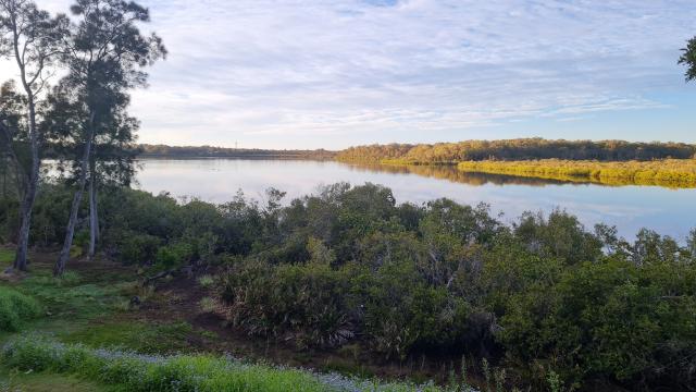
With the proposed Lake Doonella Foreshore Plan on hold pending a funding allocation in Council’s 2022-23 budget, lakeside residents are gearing up for a long battle over access issues.
It is now almost five months since Noosa Council closed the foreshore track between Shields Street and Doonella Street in response to a feud between two neighbourhood factions that threatened to erupt into violence and intimidation. While both sides have calmed down considerably to allow Council to broker solutions, the animosity remains not far from the surface, and both sides have been feverishly preparing their cases and lobbying the powerbrokers.
But this is no petty neighbourhood dispute. The mishandling of the Doonella Foreshore goes back decades and generations, and cuts to the very heart of the complex and often vexed issue of land tenure and public access to public waterways. While it may seem on the surface to be a fight for public access across lakefront land that a handful of owners believe is part of their property, it is actually a test of the will of government to hold true to its stated policy of public access in the face of a nightmarish mess of what Council’s Acting Environment Services Manager, Shaun Walsh, has described as “complex tenure arrangements” leading to “lack of clarity about the extent of private property and whether it extends to the high-water mark”.
Put simply – or as simply as you can in these muddy waters – it’s all about whether something called an ambulatory boundary can legally prevent foreshore access to a few hundred metres of land that is currently the only impediment to a complete foreshore access track around Lake Doonella, as flagged in Council’s 2020 Noosa Cycling and Walking Strategy.
The Queensland Government defines an ambulatory boundary as “where a body of water (e.g. sea or river) defines the boundary of land. An ambulatory boundary shifts with the ordinary movement of the sea or river through gradual change.” The Doonella dispute sees Council caught in the middle between the group of landowners who claim an ambulatory boundary that gives them absolute high water lake frontage, and a much larger group of residents who want to start a bushcare group and establish a public walkway along the existing Unitywater sewer alignment extending along this part of the foreshore. Both sides have commissioned compelling and expensive professional opinions in support of their arguments, while Noosa Council’s third party independent boundaries report, commissioned in September, has yet to be made public, although Environment Manager Shaun Walsh’s report to council on 7 December would indicate that its findings were inconclusive.
According to a source inside Council, the ambulatory boundary of at least one, and possibly two of the properties in question have been compromised by landfill and are therefore invalidated, but spokesperson for the group, developer Kevin Anschau told Noosa Today that the group had evidence that the landfill was done by Council more than 50 years ago in response to an erosion collapse, and the boundaries therefore remain legally binding.
Mr Anschau said: “Our group is totally supportive of a foreshore management study that provides the best outcomes for all residents, but when it comes to public access and the sensitivity of the foreshore, we think that there are already plenty of opportunities for residents and others to enjoy and appreciate these natural spaces. But, as Cr Stockwell has pointed out, no approval is likely to be given for a pathway or boardwalk below the high water mark, for both environmental and financial reasons.”
(Cr Stockwell told Noosa Today that while it was his personal view that no concrete walkway could be built below the high water mark, others at Council, including Environment Manager Walsh, believed that there were ways around the problem.)
Other landholders fighting for their boundaries include Noosa cultural icon Johanne Wright and husband Dr Ian Wright, and Dr Geoff Bowden and Mrs Carolanne Bowden. Interestingly, Dr Bowden rallied broad community support from many of the people who are now opposing his group some years ago when a proposed vehicular road along the foreshore threatened the same frontages.
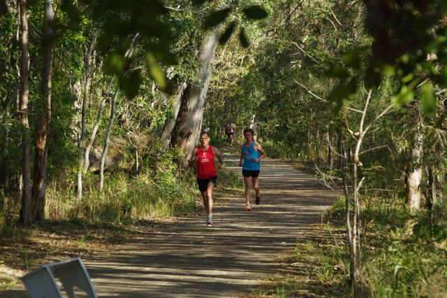
Meanwhile, in a letter to councillors prior to the recent vote to defer the Foreshore Management Plan, Tewantin residents group spokesperson Ms Jessica Lewis wrote: “Access around Lake Doonella would provide sustainable travel options connecting community to environment in the most positive of ways. It would link up safe scenic walking and bike paths for children to travel to St Theresa’s, Noosaville State School, Tewantin State School and kindergartens. Safe, beautiful connection right into Tewantin centre without having to walk/ride along Poinciana Ave. With eyes on the lake, appreciating the bird life, ecology, and ability to commune with nature. The positives are endless, and possible with proactive leaders. There are so many examples of environmentally sensitive walkways around wetlands. We have consistently asked for the access to be provided on top of the existing sewer infrastructure that extends through this area – just the same as the pathway infrastructure along Lake Doonella’s southern shoreline, where the Noosa Park Run is held weekly.”
She told Noosa Today: “We welcome the Foreshore Management Plan, which is urgently needed and overdue. We’re happy that at least Council will be putting a timeframe on resolving these issues in the not too distant future for the benefit of all residents of the Shire – not just a select few.”
The reality, however, according to Environment Manager Walsh, is that if budget is approved to fund the development of the plan in 2022-23, we are at least two years away from reaching any resolution.
Will Council’s “temporary closure” of access between Shields Street and Doonella Street remain in place for at least a further two years?


