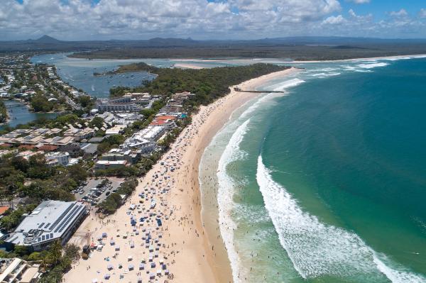
The draft Noosa Coastal Hazard Adaptation Plan (CHAP) will soon be released for public consultation as part of the final stage of the eight phase project.
The draft CHAP provides a comprehensive and coordinated adaptation program in response to increasing coastal hazard risks, specifically addressing the impacts of coastal erosion along the open beach areas as well as inundation of low- lying areas from storm tides and higher tides, and how these existing hazards are likely to change due to projected sea level rise and major storm events.
The program aims to improve Noosa Council and the community’s understanding of current and future risks from coastal hazards, consult with the community so they understand the implications and contributes to the decision making and identify what actions are required to avoid, reduce or adapt to these risks to people, property, assets and the environment.
In addition the CHAP provides mapping and visual products for use in planning, asset management, community awareness and disaster management and provides direction for a coordinated approach for Council and the community to adapt to coastal hazards.
The development of the CHAP has been undertaken under the QCoast2100 initiative, established by the Queensland Department of Environment and Science (DES) in 2016 and coordinated by the Local Government Association of Queensland (LGAQ). As part of this program Council was awarded funding of $490,000 to complete the comprehensive assessment of coastal hazards and preparing a plan to respond to these. There are 48 local governments across Queensland involved in the QCoast2100 initiative.
A detailed, eight phase program has guided the development of each step of the CHAP and has been signed off by the State Government at each phase.
The CHAP is based on a detailed assessment of coastal hazards for present day and years 2040, 2070 and 2100 including hazard modelling, risk assessments, options analysis and socio- economic analysis of preferred options. It provides a set of recommended actions for implementation over the next 5 years and presents a potential pathway for responding to these changing risks over the long term.
Many public and private assets and locations of interest to the local community, visitors and Council are exposed to the effects of coastal erosion and inundation. This includes roads, pathways, stormwater networks, parks, recreational facilities and buildings. Erosion of local beaches and tidal inundation impacting foreshore areas and roads in Noosa Shire regularly causes inconvenience and sometimes damage. The effects of climate change, particularly sea level rise and more extreme weather are likely to worsen risks associated with these erosion and inundation events. For some areas, these impacts will require management actions, further investigation and ongoing monitoring due to the likely damage or disruption to both public and private assets and impacts to public safety, business, tourism and lifestyle values.
Community feedback to date has informed the assessment of community values, future risks and adaptation options. Community input has led to amendments to the coastal hazard mapping of erosion for beachfront areas between Peregian Beach and Sunshine Beach and that this updated mapping has been made available to the public through Council’s online mapping via Council’s website.
This final stage of consultation is to seek feedback on the contents of the plan including the detailed actions recommended.
The plan will be made available for community feedback for 28 days via Council’s Your Say site before being finalised.An ongoing monitoring program is being developed to support the progress, monitoring and review of this plan
over time. The CHAP will be reviewed periodically in line with Council’s Climate Change Response Policy 2017.


