You know you’re in for a fascinating conversation when someone asks to see your creek bed.
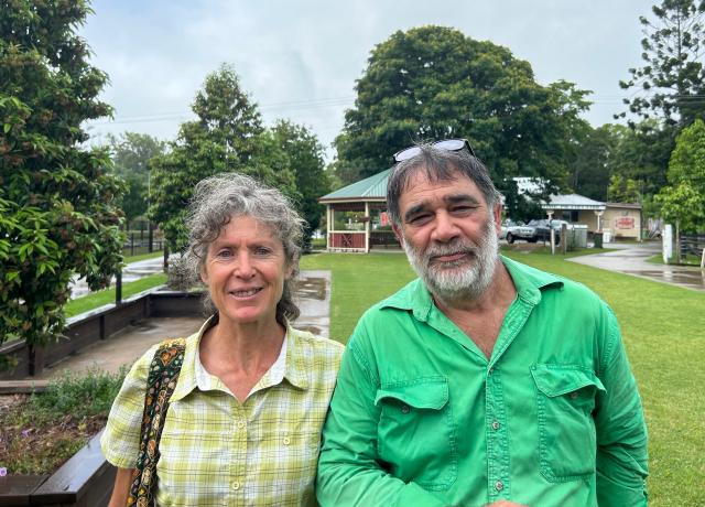
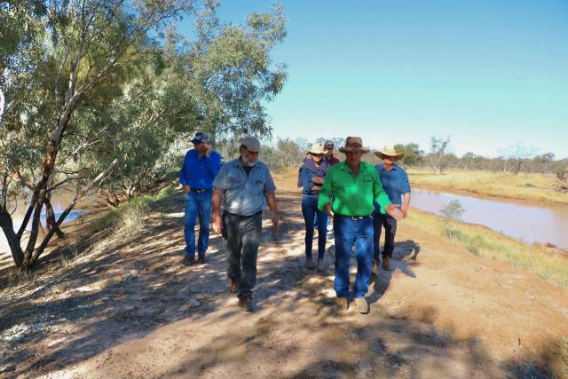
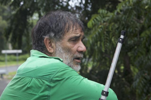
I met Peter McAdam at the Agvention field day at Kandanga last year.
Show me the lowest part of the creek on your property, he told me.
By doing that, he could help determine the health of the land – the quality of the soil, the amount of water absorption, the level of run-off.
Impressive.
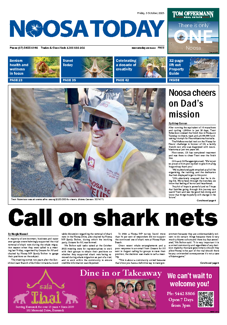
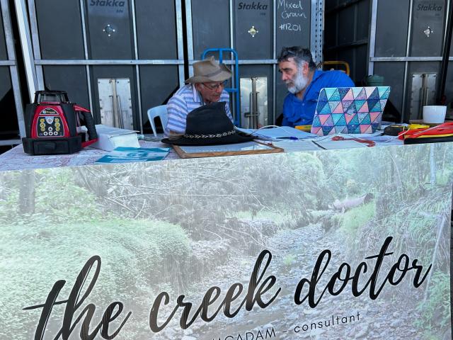
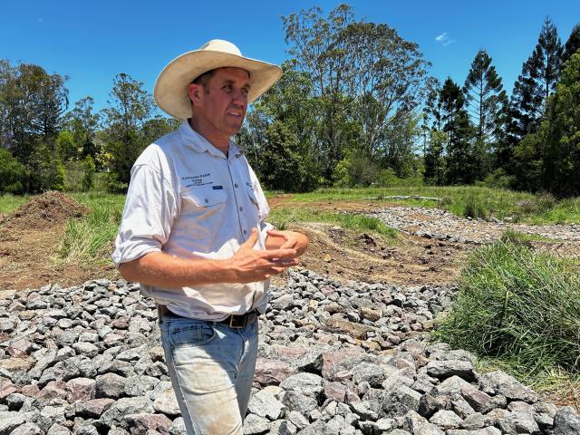
Based in the Mary Valley, Peter is the Creek Doctor; he judges the health of the waterway, what’s needed to improve it, ways in which to make the whole cycle of slow it, sink it, store it work for the betterment of the property.
This week I caught up again with Peter and partner Bronwyn at Amamoor to talk creeks, erosion, creating sustainable wetlands, creek crossings and riparian corridors – especially along riverbanks.
As well as being a qualified environmental consultant, Peter is especially passionate about investing in catchment management.
At the same time Bronwyn is head ranger for Queensland Parks and Wildlife Service at Kenilworth.
Together they run a 78ha cattle property at Kandanga comprising about half cleared for pasture improvement, and the remainder still timbered.
“I like to think of it as a koala farm,” Peter said cheekily, “but it doesn’t carry very many.’’
His passion for waterways and landscape care stems back to childhood.
Born in the UK, the family moved to Queensland when Peter was aged five.
His father held a position as a medical specialist in Mt Isa.
The lure of the bush and the stability of having an indigenous family to teach him about the environment gave the young Peter a sense of wonderment.
Days would be spent down on the banks of the Leichhardt River, among the rocks and sand of a landscape supply business.
They would dredge the huge mounds of river sand that had built-up after heavy rain, along with the rocks, stones and gravel, and use it for roadworks and construction.
There was always plenty and the licence was that no rock or sand could be extracted closer than one metre to the trees or more than one metre deep around them.
It was there that Peter realised that the continued dredging whittled the river bed down to bedrock – concrete smooth. And the trees were sitting like lighthouses out of the river, surrounded by one metre of soil.
Then after more flood-like events the soil was washed away, and with it the trees.
“I grew up in town and around horses a bit. But I spent a lot of time with a family in the bush – Mrs Donovan was a Kalkadoon woman and I learned a lot from her.
“When I finished school, I could have studied teaching but was an apprentice fitter machinist with Mt Isa Mines.
“I had a head for physics and basic maths so when I came to Brisbane a friend said I should apply to Griffith University and get in as an adult entrant.”
Peter thought he would do one year of environmental studies and transfer to engineering. Yet he liked the course and met a lot of people through it that he’s still close to.
It was an interesting time. Environmental politics was strong. The Franklin Dam was happening in Tasmania … a dam was proposed in wilderness areas that became one of the most significant environmental campaigns in Australian history.
After graduating, Peter’s first job was as coordinator for North Queensland Conservation in Townsville. It was a time of debates about resort developments and the wet tropics heritage listing proposal.
He then took on facilitation roles including being employed by the Australian Fisheries Management Authority, Mackay Regional Council for their 2020 Vision on social development,
and Queensland University of Technology’s student union.
It was at Braidwood, between Canberra and Bateman’s Bay, where he worked for a soil conservation service doing river care and catchment management, that all the planets lined up.
He met Bronwyn, who grew up on a horse and cattle property south of Queanbeyan, and worked for New South Wales National Parks and Wildlife Service.
There was plenty of political will at the time for environmental care, with Federal and State Government funding leading to big ocean, landcare and river programs all happening at the same time.
There were lots of resources available for training and meeting with landholders to better understand what they could do to improve the conditions for water on their properties.
“I am especially passionate about investing in catchment management,” Peter said. “I know that it is much more cost-effective to prevent environmental harm, than to repair and rehabilitate.”
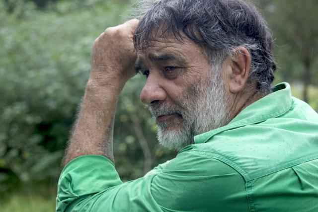
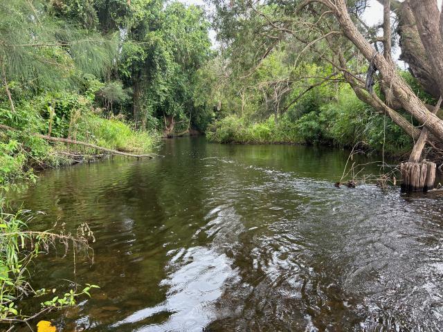
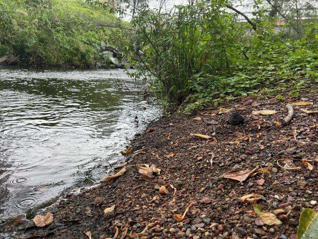
That brings me back to Peter’s initial question about showing him a photo of the lowest part of a creek and the property.
“For one thing, it gets you there – it makes you think about the situation.
“The lowest part is where most of the water drains. If that point is vegetated and reasonably wet, then everything upstream can have a much better chance of remaining wet.
“If it’s scoured out and washed away, then the chance is upstream will be washed away as well.
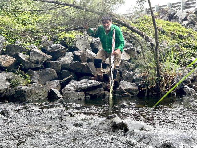
“I like visiting people’s places, talking through issues, explaining how it works. I do lots of drawings … it’s better to leave diagrams than reports as they are easier to understand.”
Working in the Hunter River region of New South Wales taught Peter that by listening you are learning, even though you’re the teacher.
Others involved in the workshops had been trained well and provided good support.
His agenda was to get people to critique his work, to pick it apart and learn from that.
Since Peter and Bronwyn moved to Queensland, he has worked with such bodies as Mary River Catchment Coordinating Committee (MRCCC), Southern Queensland Landscapes, Burnett Mary Regional Group and the Southern Rim region.
The workshops in Southern Queensland – from Toowoomba to Mitchell and Charleville – were mostly about landscape rehydration.
It’s an issue that’s complex and yet simple at the same time.
It revolves around the way our landscape has changed through the years – there are not so many humps and hollows any more.
Everywhere is downhill of somewhere else. That is like pulling a plug on a tub and the water drains out.
“The rehydration of landscapes is really about allowing more infiltration from the water that’s standing on the landscape, and the water that’s falling onto the landscape. Soaking it up.
“In order to have run-off, it’s either got to be very steep, be very full or be impervious.
“If it’s relatively flat and not impervious, the ground can soak up the water at a certain rate. If it rains very, very heavily – then it can’t soak away.
“If it can sit there for a while it can start to soak in.
“The whole rehydration thing is about not having the water run away so quickly – if it does you end up with a lot more water in the creek and a lot more destruction in the flowline from having that amount of water.
“The other thing is, the water runs past quite fast. The flood peak might be up in two hours and then down again.
“That doesn’t do much good for anybody … not for long-term habitat. It flushes out sand and gravel from the bed, scours it so much that it is washes out vegetation.
“I can understand people saying they want some fresh (water) in the creek. But the big flows going through don’t stand for long – they don’t soak in and don’t allow vegetation to get established.
“The materials in creek beds don’t get sorted. It doesn’t allow for the formation of pools and riffles.
“You want equilibrium. You need features formed from what is deposited. The rocky or shallow part of a stream or river where the water flows brokenly … that’s what a creek is meant to look like.
“Stones are sorted naturally by size. You don’t get that without being close to equilibrium. It won’t happen over night – it happens over a long time.
“If you dig a hole and the water works its way over that – it all becomes mobile and the erosive process works its way up.
“It’s good to get people to think. If the water goes downstream and the sediment goes downstream, which direction does the erosion go?
“Upstream. Yet half the room will say downstream.
“Another example is an ice-cube tray – fill it at the top and the water flows down. You cannot have those individual pools of water in a creek without riffles.
“Everything is fine when the creek is flowing but once the water stops coming in at the top end, if you want a pool of water, there has to be something holding that.
“If you ask what is the control on the bottom of that pool, chances are they haven’t thought about it. Once you mention it, they get it and they’ve got it forever.
“Is it a rock bar, a riffle, a log … it’s really simple stuff.”
While Queensland is not far from full field capacity for water at the moment, evaporation is a continual issue.
In South East Queensland the evaporation rate is 1500mm per annum while average rainfall is 1200mm, so it’s always going to be in deficit.
We shouldn’t expect there to be standing water all the time but for it to soak into the soil and be stored at depth.
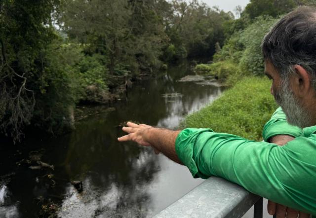
The health of the Mary Valley is up for debate as more and more residential development and farming takes place.
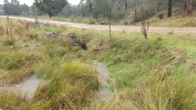
“A lot of the Mary River is still getting straighter and deeper – the channel itself,” Peter said.
“As it gets deeper, then the flood waters are more confined so there’s significant scour.
“There’s been a lot of good investment into bank protection in the Mary but the district might have overlooked the importance of stabilising stream beds.
“I still believe you can’t effectively stabilise a stream bank until you’ve stabilised the stream bed.”
A simple way of caring for waterways and erosion control is stabilising creek crossings.
Not enough thought has gone into it in the past – the horse would just go through, the cattle would go through, then push a truck through, then push a bigger truck through.
That would create muddy, unstable creek banks and creek beds.
“People ought to spend more time looking closely at what works,” Peter said. “You can see crossings that have worked well for generations.
“Too often we drive over them without stopping to have a look.
“There are lots of ways to replicate things yourself. It’s not really nature’s thing to drive a truck across the creek … but there’s a difference between people who will go to extraordinary lengths to create or protect a bit of infrastructure and those who consider the natural stream is subservient to their wishes.
“If you can have a proper look at it – come up with a design to get some equilibrium in the natural system – then it will hold up and be a useful bit of infrastructure for a very long time.
“It doesn’t take much. You can get people to flip their thinking from one way to another.”
Fencing a watercourse for stock is one of them – protecting the riparian corridor. A lot is being done around Gympie … it’s not a fix-all but it is beneficial.
It’s not a free ride, and land-holders need to see a benefit in fencing a waterway. That comes from increased productivity as well as a more stable environment.
“People will struggle with the design,” Peter said, “because they suddenly think they have to turn themselves into a national parks planner to protect this fragile eco-system.
“If you can say no, you’re just doing what you’ve always done … just build a fence to keep your cattle in and you will get what you want.
“They know how to fence their cattle in. They know how to do their paddock design, their laneways.
“The bit you want to protect is what is left. This works for a lot of people, a lot easier … if you can get them to think that way.
“With most of the stuff – just about any land care or river care project – if you can put some thought into access, like put in a gate or consider how are you going to get to your worksite or move around your farm.
“You’re better off if you firm that up and it becomes more economical.
“People will see an environmental problem that might be in a remote part of their place. They may not go there much but if they invest in that, monitor it, then they will value it.
“They might feel like it’s not their project but belongs to those who provided the advice. If you have a riparian project and can stabilise that area, say with a creek crossing that enables you to get to other areas of the farm, then you feel like you own it.”
One of the great things about riparian fencing is having a linear feature on a property that makes it easier to break up the areas in between.
This could be to create smaller blocks for cell grazing but there is always laneways to move the stock along. But there’s no point doing it if the stock are left to trash the paddocks.
Physical access and management to the proposal is one thing but legal access might come into it as well.
“You need to have both those things worked out, particularly for urban works,” Peter said.
“You might want to have a good working relationship with council, neighbours, railways. If you want good ownership and want it (the waterway) to be maintained, you need to be able to get in there.
“If you look at works on gullies and creeks done on the Bruce Highway, all of their works are designed for a one-in-a-hundred-year event.
“They use oversized rock to catch the water, high bridges so it can go underneath. They can do all the things most land-holders can’t afford to.
“For them, it’s more realistic to design for events happening once every year or once every five years. It’s a balancing act between cost and risk, and you try and find a sweet spot as a land-holder to invest enough to make it worth doing but not blowing the budget.
“They might be able to provide plants to hold the earth together so that it stabilises properly before another flood.”
When dealing with creeks, most time is spent with the water flowing down the creek or water flowing over the banks of the creek … not so much about water falling from the sky and dislodging particles, as it would be in a farming landscape.
“Dislodging soil in farming – whether you’re ploughing and how steep it is – all come into it, and all determine how much water ends up in the creek – and how much sediment.
“The maximum forces coming along are to do with the water flowing down or over the banks of the creek. It’s about the force of water on the ground. People sometime miss this but it is an important part of the design process.”
There are good signs in the way landholders and government departments are moving, Peter said. It’s normal now to install bedrock under a bridge whereas previously the abutments were brought in and the land would start to erode underneath.
“Little by little people are adopting it. Shire road-workers are out there fixing up bridges and culverts.
“Landholders can do stuff at a scale that is relevant and affordable. Once you jump up another level, you’ve either got to get in at policy level or design level.
“You get to a point where there are scale issues and it’s expensive to go back and retrofit things.
“You’re also up against the preconceived notions – particularly in an urban situation – of getting the water away quickly.
“It’s not the depth that drowns people, it’s the velocity. You’ve got to turn that thinking around and start to look for places you can have greater ponding on the flood plain.
“Where the flood plain is developed, the creek either floods – and you have infrastructure threat – or you contain it.”
Given the sheer volume of water that has fallen from the sky already in 2024, Peter’s words and work seem poignant to the future consideration of town planning and regenerative farming strategies.
To take a drive through the Mary Valley and see Peter’s words unfold as you cast an eye over our green landscapes and meandering creeks, shows how important his work is to the future sustainability of farming and recreational practices in our region.