Coming hot on the heels of the Maritime Safety Queensland Noosa River reforms statement, the Queensland government’s release on 3 May of not one but three reports explaining the Cooloola Recreation Area’s proposed new management plan may well be regarded by some as information overload.
But the key report of the package, the draft management plan, will be seen by those who have followed the history as the most important document on Cooloola to be released in 30 years. In 1994, in perhaps the Goss Labor government’s crowning achievement on the environment, the State released the Great Sandy Region Management Plan, which in two sections – Fraser Island (now K’gari) and Cooloola – laid out in great detail the proposed future for the most important aggregation of national parks in South East Queensland.
Announcing the Great Sandy Plan in 1994, then-Environment Minister Molly Robson said: “With the end to sand mining and logging on Fraser Island, the World Heritage listing of the Island, and the extension of national parks in the region, the opportunity has been created to preserve the natural beauty and the essential evolutionary processes of the region. That opportunity is grasped in the Great Sandy Region Management Plan, as implementation of the Plan will preserve this rich heritage and share it with all who would benefit, without diminishing the natural splendour and life of the region.”
And that is pretty much what has happened. The Plan was revised by the Department of Environment, Science and Innovation in 2005, 2011 and 2018 in line with changing times and important issues like climate change, fire and the design and implementation of partnerships with Traditional Owners, but the core strategies outlined in the 1994 Plan remain largely unchanged. The dynamic which has changed, almost beyond recognition, is the volume of visitation which has stretched carrying capacity to breaking point in some sections of the Cooloola Recreation Area, and this is the issue that carries the weight of the proposed Cooloola Plan.
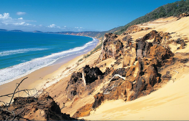
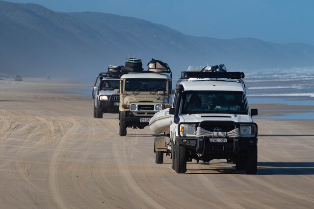
Up until 2011 Queensland Parks and Wildlife Service increasingly struggled to manage increasing beach camping and 4WD driving numbers on Teewah Beach and Rainbow Beach because the boundary of Cooloola National Park only extended to the high water mark. With numbers and behaviours spinning out of control, a Cooloola Recreation Area was gazetted in late 2010 to give QPWS power to co-manage the beaches with other State agencies, as well as solely managing Cooloola National Park. Since 2011 QPWS and other agencies have introduced camping limits, speed limits, and increased behaviour education and policing. Then, when Covid hit us in 2020, beach driving numbers, and hooning in particular, reached new high levels. The current Cooloola Recreation Area draft plan aims to address these beach challenges.
Commenting on the release of the Cooloola Recreation Area Sustainable Visitor Capacity Management Study, a feeder document for the Plan, current Environment Minister Leanne Linard said: “In 2023, people spent more than 182,000 camper nights in the Cooloola Recreation Area, and almost 100,000 vehicle access permits were purchased. With increasing patronage, fuelled in part by South East Queensland’s growing population, there’s a risk the area’s unique natural environment will be adversely impacted if we don’t manage the area correctly. It is important that well informed planning is at the forefront of QPWS’s future management of the park and recreation area.”
Given that this is the first time in 30 years that our community has had the opportunity to comment on an overarching plan for Cooloola, and that we have less than three weeks to do so (before the 4 June deadline) you would think that the focus would be on the big issues, like beach traffic, hooning and bush toileting in the dunes, but in the first week since the release of the draft plan, social media posts have been busy breeding confusion.
Said one poster on Facebook: “The omission of the fact it is a National Park, by calling it a ‘Recreation Area’, is cause for concern. This suggests the Cardinal Principal (sic) could be at risk and the area may be open to private development within the park boundaries.”
Another agreed that this was potentially a strategy to circumvent the principle governing commercial operations in national parks: “Exactly, no mention of Cooloola Great Sandy National Park in the document – just ‘Cooloola Recreation Area’. A big error that needs to be pointed out in submissions – this whole area is a gazetted National Park, it should be protected by the Cardinal Principle.”
But the front cover of the 56-page Draft Management Plan explicitly reveals that the area incorporates “Cooloola Recreation Area, Cooloola (Noosa River) Resources Reserve, Great Sandy Resources Reserve, Double Island Point Conservation Park, Sheep Island Conservation Park, Goat Island (Noosa River) Conservation Park, Womalah Resources Reserve, and the Cooloola Section of Great Sandy National Park”. A few pages on it further explains: “The Cooloola Recreation Area … is an overlay for the establishment, maintenance and use of the area. It enables the provision, coordination, integration and improvement of recreational planning, recreational facilities and recreational management for the area. There is a specific focus on the conservation, cultural, educational and recreational values of the area, and the interests of area land holders.”
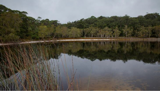
Putting that another way, the Cooloola Section of the Great Sandy National Park, which makes up about 90 per cent of the CRA, has very little to worry about, with most of the potential problems, including those of the perched and barraged lakes and the upper Noosa River, identified in the draft plan as low or very low threats. By contrast, almost all of the problems identified in the other 10 per cent outside the park are regarded as high or very high threats, including – you guessed it – Teewah Beach between the Noosa River and Double Island Point, the Double Island Point day use area, and along Rainbow Beach to Rainbow Beach township. If the Cooloola Management Plan covered only the national park, it would be missing these key issues.
The draft plan explains: “The 65-kilometre beach [Teewah] provides one of the few beach driving opportunities in South-East Queensland, with 80 per cent of visitors coming to the area from between Noosa and Brisbane … Visitors can expect high numbers of people, long wait periods at barges and access points, and limited opportunities to have space to themselves when visiting on weekends, public holiday long weekends and school holiday periods.”
The Plan identifies the primary threat as “loss of visitor experience due to increase in visitor numbers, particularly during peak periods, causing congestion at access points, long wait times and limited space at popular visitor nodes. High numbers of visitors impact natural and cultural values of sites. Threat rating: Very high.”
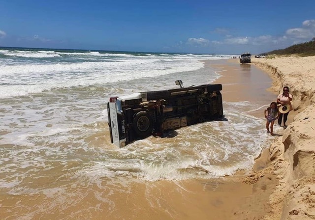
A secondary threat of “risk to visitor safety caused by poor visitor behaviour, including drink driving, driving dangerously and driving at high tides, also impacting the visitor experience and the natural and cultural values of the park” is also rated as very high. “Visitors driving at high tide and parking on dunes significantly impacts coastal dune areas by physically changing the structure of the beach (including erosion). Vehicle impacts kill dune vegetation and impact species habitat and breeding areas (turtles and shorebirds).”
The draft plan also gives a very high threat rating to some existing commercial operators: “Poor quality of delivery of organised and commercial tour experiences, such as commercial operators who do not provide quality visitor experiences while ensuring the protection and conservation of values within the recreation area, and permit holders operating outside of their permit conditions, leads to diminished visitor experiences and impacts on natural and cultural values.”
Finally, the draft management plan takes aim at the seven zones that make up the 15 kilometre-long beachfront camping zone on Teewah Beach, explaining: “Campers are largely self-sufficient [and] are required to bring their own portable toilets to ensure the health of
themselves, other visitors and the environment are not detrimentally affected by their stay in the camping zone. The condition, health and aesthetic value of the foredune ecosystems is strongly linked to the visitor experience, with iconic stands of pandanus and casuarinas and intact foredunes sustaining and enhancing this experience.”
Identifying the primary threat as high, the draft plan says: “Loss of visitor experience in the beach camping zone due to overcrowding, competition for campsites, increasing noise at night and anti-social behaviour (parties). Excessive visitation within the camping area results in damage to foredune ecosystems, increased litter and reduced water quality.”
The secondary threat from bush toileting was also rated high: “Visitor health is at risk from the high number of visitors bush toileting in dunes in beach camping zones (i.e. spreading pathogens from exposed human waste and toilet paper, or contaminating groundwater or beach flows).”
Of course identifying threats is one thing and addressing them is another, but the draft Cooloola Recreation Area Management Plan is considering a range of responses to streamline its services, manage visitor numbers and compliance issues. These include developing a visitor strategy that might include different camping zones for different kinds of visitors, such as family groups, larger groups and caravanners, vehicle exclusion zones and time limits at key sites.
Another idea being considered is a new approach to commercial operator permits. Page 47 of the draft plan offers under its management section: “Ensure third party contractors, commercial tour operators and leaseholders’ capacities and conditions remain within limits identified in the visitor management strategy, and that any future arrangements are only considered within the identified capacities of the sites or park.”
While this may be misconstrued as an invitation for more permit applications, an informed source tells Noosa Today: “The reality is that people apply for permits to run day trips and so on, and have done for many years. A huge number are issued, but in many cases they are never used, or they’re used for a short time and the business goes belly-up, and the permits are traded. What the draft plan is suggesting here is more of a use-it-or-lose-it approach. Some will probably read it as encouragement of more permits, but that’s not the case. What the government really wants to encourage is new players coming in with marketable projects that can be controlled with high level eco-certification.”
Not everyone was thrilled with the Cooloola draft plan documentation. Noosa Independent MP Sandy Bolton, a key driver on this issue within the parliament, wrote in her 360 newsletter: “Given our long journey working on needed changes within the management plan, some of the government’s responses lack the needed urgency, and we will be responding to this. We encourage all residents to have their say through this consultation period, while we continue to advocate for better outcomes where identified.”
Organisations and members of the public are encouraged to have a say on the management of Cooloola Recreation Area. Submissions on the draft management plan can be made via the Queensland Government’s Get Involved website, getinvolved.qld.gov.au, or intheloop.des.qld.gov.au/cooloola-recreation-area.
For further information on the draft management plan or the planning process, visit the Department of Environment, Science and Innovation website, des.qld.gov.au

