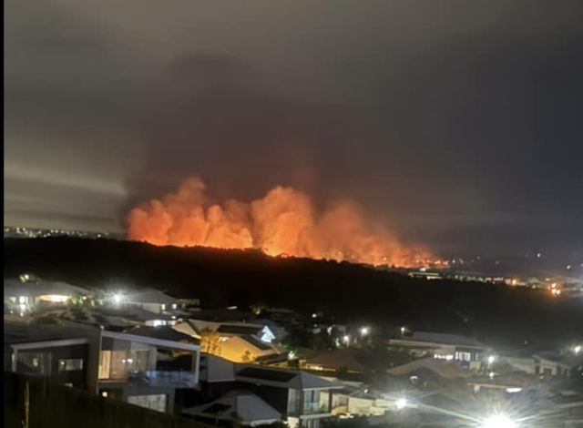
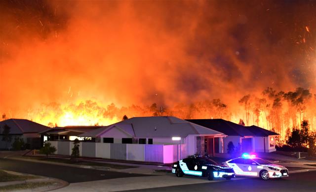
The smell of smoke thick in the air triggered Peregian residents last week when they were unable to find any information of the fire via online maps.
The Peregian Beach bushfires in 2019 were a stark example of how fast a disaster can strike without warning, so it’s easy to understand the frustration from residents seeking instant information.
Local resident Sharyn Kerrigan said, “It puzzled many locals last night and made them uncomfortable to go back to sleep not knowing where it was.“
“We have built a lot of trust for our fire department and our local council systems for early detection.”
The fire in question was a Permitted Burn at 330 Yandina Coolum Rd, Coolum Beach, found on the Permit to Burn Map on Queensland Fire Department (QFD) website.
“It may have been on this site but this is not where the community is looking at midnight when smoke fills the air around your house,“ Sharyn said.
With multiple online fire maps available, it’s important to know where to go first.
A spokesperson for Noosa Council said the first map the community should check in the case of a fire was at fire.qld.gov.au as the Council only add information on their Disaster Dashboard if they are notified by the QFD.
If the fire requires a warning, QFD issues it via their Facebook page and notify council, who will then provide warnings to the community.
Unless there is a threat to life or property, then it is handled like any normal fire and warnings are not issued, which seems to have been the case with the recent Permitted Burn in Coolum Beach.
If it is a controlled burn, then council are notified and share the information via media, their website or their Facebook page.
During the launch of Get Ready Queensland back in October, Noosa Mayor Frank Wilkie said it was a matter of when, not if, our region would face severe weather and we all had a role to play in keeping people and property safe.
“Severe bushfires and major floods have struck the Noosa Shire and Sunshine Coast over the past five years, forcing thousands of people to evacuate from their homes,’’ he said.
“These events isolate communities and cause millions of dollars in damage to roads, businesses and infrastructure across both local government areas.
“We can’t control the weather or when the next disaster strikes but we can prepare ourselves by understanding how a natural disaster might affect where we live, preparing an emergency plan for our homes and packing an emergency kit.
“Both Sunshine Coast and Noosa councils are leaving no stone unturned to ensure we are ready to respond individually and collectively for the safety of all our local communities.”
Sunshine Coast and Noosa residents are urged to take the following simple steps to boost resilience and safeguard themselves, their families, homes and businesses:
Step one: Understand your risk.
Step two: Prepare a household emergency plan.
Step three: Pack an emergency kit.
For a full list head to getready.qld.gov.au
To check for fire information and updates visit fire.qld.gov.au
For the latest updates, practical resources and what to do before, during and after a disaster strikes, visit disaster.noosa.qld.gov.au (Noosa Shire) and disasterhub.sunshinecoast.qld.gov.au (Sunshine Coast region).


