The campaign to restore a community access track around the northern shore of Lake Doonella is back on track, following the release of a Noosa Council survey confirming property boundaries.
As reported by Noosa Today last August, the lake shore access track between Werin Street and Moorindil Street, Tewantin, was temporarily closed by Council pending a boundaries’ survey following a dispute between foreshore property owners and a residents’ action group now known as Lake Access and Conservation Community (LACC).
LACC spokesman Jessica Lewis said the group had sought the results of the survey through an application under the Right to Information Act, which was granted last week.
“The good news is that it confirms what we always knew was community land,” Ms Lewis said.
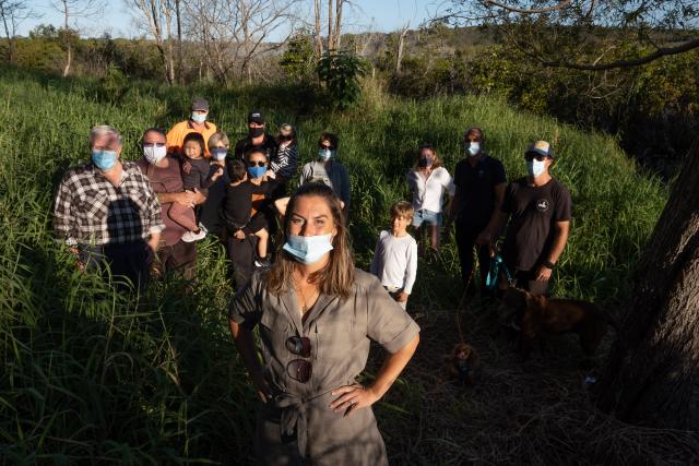
Back in August 2021, the access dispute between neighbours reached flashpoint, as Noosa Today reported: “They came in their dozens, an hour or so before sunset, all with masks, some with dogs or children, to defend their right to public space, however small it might seem to the outside world.
“Just before dark they were joined by Councillors Amelia Lorentson and Joe Jurisevic who listened to the reasoned pleas to restore vegetation and provide access for all to this special pocket of Tewantin.
“Cr Lorentson later told Noosa Today: ‘When a community cares, I care. I love the collaborative attitude of this residents’ group. They’re not asking for a handout, they’re asking us to help them clean up the wetlands and preserve this precious asset, just as we’ve done elsewhere in the Shire.’
Fortunately, there was ultimately a tacit agreement to calm down and let council sort out the matter, and the first step in that process was the boundaries’ survey.
The survey report says in part: “An investigation of the site and available aerial photography and lidar data appears to disclose that the land along the southern boundary of Lot 3 and Common Property on BUP4248 and parts of Lot 15 have been subject to substantial filling. These works appear to have been carried out in the past and may be a result of construction of buildings. Accordingly, the subject boundaries in these areas have been defined in accordance with the field notes of the survey of the Registered Plans.”
“In plain English, this proves that there is a public foreshore area here like there is elsewhere in Noosa, such as the Tewantin and Noosaville foreshore,” Ms Lewis said.
“Yes, it is prone to flooding on occasion but most of the time a low-key access path that engages with the lake will be used for the recreation and enjoyment of the whole community.
“We put a lot of effort into the submission process to achieve these actions. It’s a slow burn, however, we can see these small steps are progressing our cause forward. The next steps are to ensure the track be reopened as part of the Lake Doonella Foreshore Management Plan process.”
Noosa Council has endorsed a budget for a Lake Doonella Foreshore Management Plan to commence in the first half of 2023, as well as funding for a Bushcare officer to form a group to handle weed clearance at Doonella.
In correspondence with LACC, Cr Brian Stockwell said: “There was a lot of support for the Bushcare officer amongst councillors and we managed to squeeze into a start in January without going into deficit.
“There are about four local groups wanting to start Bushcare, which is a really positive thing. In terms of Lake Doonella, the thinking is we will hopefully be able make a start on the Foreshore Plan in the first half [of the year] and then start the implementation in the second.”
Ms Lewis said LACC welcomed the funding for some immediate track improvements around the lake and looked forward to working with Council to improve access right around the Lake and assist with Bushcare and regeneration efforts.


