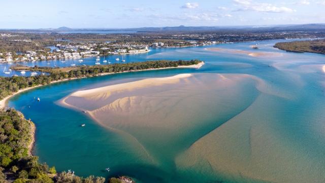
Noosa River has lost its long held A-rating, dropping to a B rating on this year’s Healthy Land and Waterway report card.
The report card, released on 17 November, recorded significantly increased pollutant loads from moderate to very high, with sediment [mud] load increasing from 349kg/ha in 2021 to 1112kg/ha in 2022.
Run-off also delivered very high loads of nitrogen (19.3 kg/ha) and phosphorus (1.6 kg/ha) to waterways.
The change was attributed to very high rainfall and river flows experienced over the summer months, transporting pollutants from agricultural peri-urban urban areas downstream.
Considered a largely intact coastal lagoon system, the Noosa River stretches from the Great Sandy National Park to the river mouth with urban areas concentrated around the lower estuarine reaches where extensive land clearing has occurred.
The freshwater creeks declined from excellent to good condition, with a decline in macroinvertebrate community health at Cooloola Way.
River bank vegetation in the catchment remains good with 89 per cent cover, and wetland extent remains excellent with 88 per cent cover in the freshwater reaches. The extent of wetland habitat in the estuary also remains excellent, with 90 per cent of mangroves and saltmarshes remaining. The report found higher levels of bank vegetation and estuarine habitat supported valuable commercial and recreational fisheries and stoped the erosion of sediments into the waterways.
Estuarine water quality was reported as having a slight decline but was still considered to be in excellent condition.
Turbidity within Lake Cooroibah and Lake Cootharaba declined slightly this year. Nutrients (total nitrogen and total phosphorus) and chlorophyll also declined slightly, though remained excellent.
Despite the drop in water quality, the river scored well in terms of resident satisfaction.
It found 78 per cent of residents were satisfied with the local waterways, and 74 per cent gained a very high level of personal benefit from using their waterways, compared to 57 per cent for all of South East Queensland.
The report found 53 per cent of residents used the waterways at least daily, among the highest within South East Queensland with top activities being walking or running (107 days/year per resident), enjoying nature (76 days/year per resident), swimming (28 days/year per resident), and picnics/barbecues (28 days/year per resident).
The report placed a recreational value on the waterway at $2865 per person/year.
A number of priority areas for improvement were identified in the report.
Of top priority was protecting and managing existing values from the pressures of population growth, reducing sediment loads and nutrients entering waterways by implementing activities in priority catchments such as Ringtail Creek, Lake Cootharaba and Kin Kin Creek and continuing support of management as outlined in the Keeping it in Kin Kin plan.
It recommended a focus on engagement and compliance within industries with high soil disturbance, such as agriculture and development and continued investment in minimising wastewater treatment plant and other industrial discharges as well as protecting existing riverbank vegetation and wetlands and making it a priority to increase waterway buffers within the peri-urban/agricultural landscape.
Currently 89 per cent of the river banks in the Noosa catchment are vegetated, and 88 per cent of freshwater wetlands remain, the report stated.
The report recommended supporting community groups to deliver actions to improve catchment and waterway health, providing education campaigns on the respectful use of beaches, state forests and greenspace areas and supporting projects that strengthen Kabi Kabi connection with sea, such as re-establishing extinct oyster reefs.


