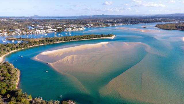
Seagrass distribution in the Noosa River has declined a staggering 80 per cent in the past 20 years, according to reports prepared by Ecological Service Professionals for The Nature Conservancy (TNC) and Noosa Council.
The reports titled Current and Historical Distribution of Seagrass in the Noosa Estuary and Seagrass Distribution Study were delivered to council this month.
They attributed the decline to a range of elements including a large amount of sediment caused from land erosion, particularly a large-scale flood in 1992, river bank erosion from boat wash, direct damage to seagrass by boat mooring and anchoring, shifting sand banks smothering seagrass and algae growth on seagrass.
“We’re looking into where to go from here, working with TNC and other interested parties. It will need to be a collaborative effort between parties,“ officers told last week’s council meeting.
When asked what the outcome means to the ability to catch fish or carbon uptake, officers said the seagrass was an important habitat for prawns and fish and marine life such as dugongs.
“There’s very little seagrass for them to feed on,“ they said.
“We’re still looking at carbon.
“Going forward we have to look at how to reduce sediment.“
Councillors voted in favour of staff recommendations that Council’s integrated water quality monitoring program would identify options for future management strategies and factors influencing seagrass decline, that seagrass monitoring and restoration would be considered as part of the final Noosa River Plan, and funding would form part of upcoming budget deliberations.
Cr Brian Stockwell said this was the third report showing the Noosa River in decline.
“Though we have good water quality we’re having a cascading effect leading to biodiversity loss – all linked to sediment, and what’s happening up the river and what’s happening at the spit.
“Seagrass is an indicator of the unhealthy condition of the catchment. We do need to understand the source of sediment that’s causing the impact on the river,“ he said.
Cr Stockwell said previous studies had shown sediment stores on the bottom of Lake Cootharaba and a large amount of soil erosion, but not how much was making it into the river.
“With 100 per cent certainty stream bank erosion is making it into the river,“ he said.
“We know excluding cattle from banks improves the amount of sediment going into the river. We have urban issues – boat wash causing erosion from banks. Lake Cootharaba and Cooroibah have sediment that’s been locked up for centuries.“
Making the spit a permanent construction has prevented the river mouth from performing its natural function in flushing the sediment out to sea and had instead turned it into bathtub reducing its ability to flush, he said.
“The river is within our shire. It’s our fault. We can’t blame anyone else but ourselves,“ Cr Tom Wegener said.
Cr Wegener recently asked how the Keep it in Kin Kin program, aimed at reducing soil erosion into the river, was going, only to be told it had progressed about four per cent of the way.
“We haven’t done all that much,“ Cr Wegener said. “There’s a long way to go.“
He believes regenerative farming would solve the issue.
“You have to share the vision of resilience, with better land management and better farming practices,“ he said.
“We have to look much wider to approach this.“
Cr Wegener said the approach needed Noosa Landcare to support local farmers, cattle to be watered on land halting their need to trample the riverbanks and Land for Wildlife participants to plant trees along the river.
“We want to stop the silt. How do we do this? If we have this vision of where we want to go we’ll get there.“
TNC’s report was compared to a “comprehensive and detailed mapping study of seagrass“ undertaken in 1987 and several small-scale studies and monitoring programs completed in more recent years.
The study included a review of historical data and recent field surveys.
“The change in seagrass distribution was mapped from historical imagery and this information was used to provide an analysis of the changes in seagrass distribution through time from September 1989 to May 2020,“ it states.
“The assessment identified a total of 56ha of seagrass throughout the estuary, with the greatest extent of seagrass occurring in Lake Doonella and along Weyba Creek.
“When compared to previous assessments, there was no seagrass recorded upstream of the ferry crossing in 2020.
“It was found that there has been a large decline in the coverage of continuous and dense seagrass beds in several areas of the Noosa Estuary since 1989, with an estimated loss of up to 83 per cent of seagrass in this time, and some areas such as Lake Weyba where seagrass has been completely lost. Only a small amount of recovery has been identified in areas in Lake Donnella.“
The report recommended “an adaptive approach that examines and implements measures that maximise the resilience of seagrass beds, including the ability to respond to future natural disasters and human pressures that are predicted to increase in the future”.
Council’s Environment Services will continue to liaise with TNC to discuss management strategies.


