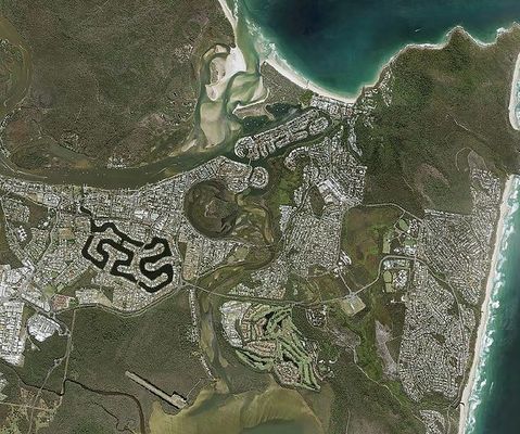
NOOSA Council is driving community engagement, thanks to new software from Sydney-based global technology company Pitney Bowes Software.
The new software, installed on council’s website, is designed to improve public access to information via online mapping services through what is called Spectrum Spatial Analyst mapping software.
The software means locals and visitors to the region can now access maps of a complete range of local community information and services.
The Pitney Bowes solution allows residents to easily search for and accurately locate council services, including property information, planning scheme zones, flood zones and fire hazards, public transport and bike paths, bin and recycling collection days, and emergency information such as evacuation centres and routes.
Being a tourist hot spot, visitors can access information such as the location of WiFi access points, parks, playgrounds, beach access, surfing and fishing spots, and boat ramps.
This information can also be accessed via mobile devices at any hour of the day.
For the council, the self-service solution increases internal productivity by significantly reducing the number of calls the customer service line receives.
Noosa Shire Council ICT manager Justin Thomas said improving community engagement and satisfaction was a priority for council.
“With Pitney Bowes, our citizens have access to the information when they want it and how they want it,” he said.
“Additionally, the software solution can be hosted in the cloud, which means tremendous cost savings for the council.”
Pitney Bowes Asia Pacific vice-president and managing director David Hope said the company had been able to assist Noosa Shire Council to address its challenge to drive community engagement and
position itself at the forefront of the government’s wider digital transformation plan.
“Our mapping solutions deliver the accuracy and precision communities require as they engage with citizens online,” he said.
Services mapped out online

Digital Edition
Subscribe
Get an all ACCESS PASS to the News and your Digital Edition with an online subscription
New police commissioner appointed
The State Government has appointed Brett Pointing as the Commissioner of the Queensland Police Service, following the retirement of Steve Gollschewski.
Newly appointed...


