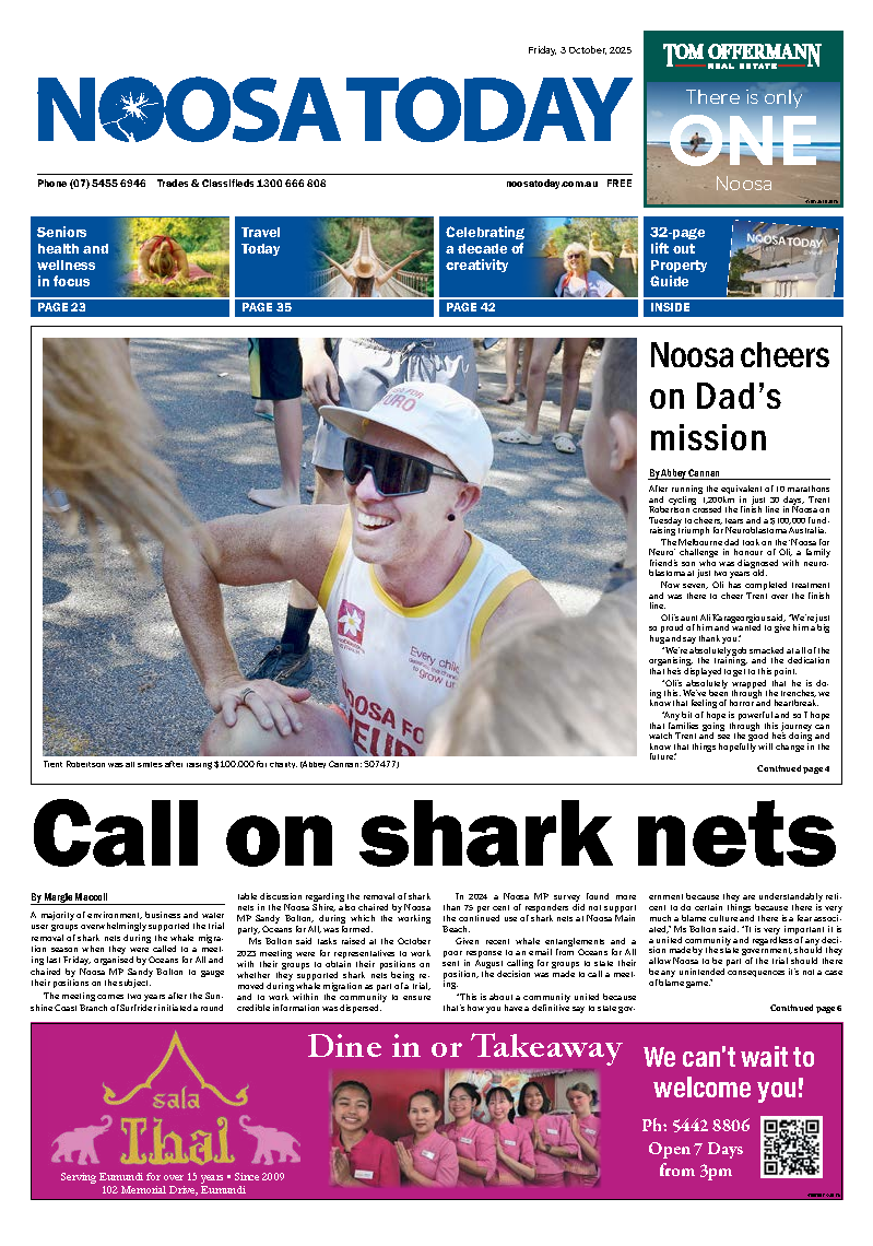
A new university programme using drones and artificial intelligence to protect south-east Queensland’s endangered native animals could be soon available to conservation groups around the country after landing more than $300k in funding from Landcare.
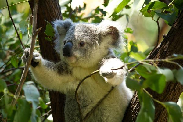
With an initial focus on koalas, researchers at QUT will create a wildlife conservation network using an AI (artificial intelligence) powered data hub, combined with the use of drones equipped with infrared cameras to better detect the creatures.
Rapidly detecting the animals from the air over large areas, sometimes in locations inaccessible on foot, Landcare and conservation groups from anywhere in Australia will soon be able to partner with the team to transmit the data to the Conservation AI Hub at QUT, offering faster, more accurate monitoring of population numbers.
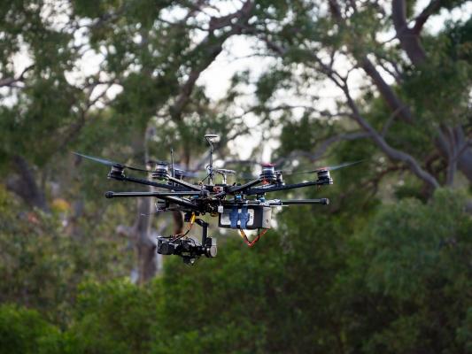
“It’s a game changer,’ says Associate Professor Grant Hamilton, project lead from QUT’s School of Biology and Environment Sciences and Centre for the Environment.
“Despite decades of research, the 2019-2020 Black Summer bushfires highlighted just how little is known about the presence and abundance of wildlife across vast tracts of the Australian landscape. There were estimates of billions of animals killed or displaced – but these figures were by necessity based on modelling rather than monitoring, and this lack of data means priority areas for protection could not be established.
“As one example, the impacts of bushfire on koala populations in south-east Queensland were clearly evident but difficult to quantify because of a lack of baseline data.
“This system will allow Landcare groups, conservation groups, organisations working on protecting and monitoring species to survey large areas in their regions, anywhere in Australia, with the use of drones and thermal imaging detection, and send the data back to us where we can process it. It’s citizen science on a much bigger scale.”
“One pioneering aspect of the system is the inbuilt connection between landscape level monitoring, rapid processing with AI, and efficient return of the processed information directly to the groups who will actually conduct on-ground management,” Professor Hamilton said.
With plans to trial the system with Noosa and District Landcare and Watergum, Professor Hamilton added while monitoring of koalas on foot produced around 70 per cent accuracy in numbers, “we’ve demonstrated that this new system is can on average detect 85 per cent of what is out there, up to 100 per cent, and over a much greater area”.
Rachel Lyons, Business and Partnerships manager, Noosa and District Landcare agrees the innovative new programme combined with ‘boots on the ground’ will create a far more rapid, accurate and efficient system in population assessment.
“Our landcarers and volunteers understand the primary indicators of impacted habitat and species decline but what we have in knowledge and experience, we lack in budget and resources,” Ms Lyons said.
“And we’re one of the larger Landcare groups but there’s only so much we can achieve in bushfire recovery. So by working together with QUT on this project, we gain expertise in thermal imaging assessment, data monitoring and so much more. Right now, I’m in the process of training myself and several members of Noosa and District Landcare in drone operations and project reporting. This will revolutionise how we function in the future, especially as extreme conditions increase, it’s more important than ever to innovate and evolve.”
Supported with $325,000 from the Landcare Led Bushfire Recovery Grants, the new programme will develop the capacity of existing Landcare and other community groups to conduct drone surveys for wildlife detection, drawing on their local knowledge, skill and expertise to enable effective on-ground management for koalas and a range of other species in key areas.
“This system will allow for targeted on-ground activities to achieve management outcomes for koalas and other wildlife in bushfire affected areas, effectively and efficiently increasing resilience of these areas. And it can also be used to identify pest species for management in these areas,” Dr Hamilton said.
Funded by the Australian Government, the $14million Landcare Led Bushfire Recovery Grants are supporting projects in regions impacted by the Black Summer bushfires of 2019/2020.