By JONATHON HOWARD
WEATHER predictions from the Bureau of Meteorology show increased storms are heading towards Noosa this weekend, but dry and hot conditions are expected to return for the first two months of 2015.
Senior forecaster Pradeep Singh said that in November temperatures climbed to a high of 40.5 degrees in Tewantin on 16 November.
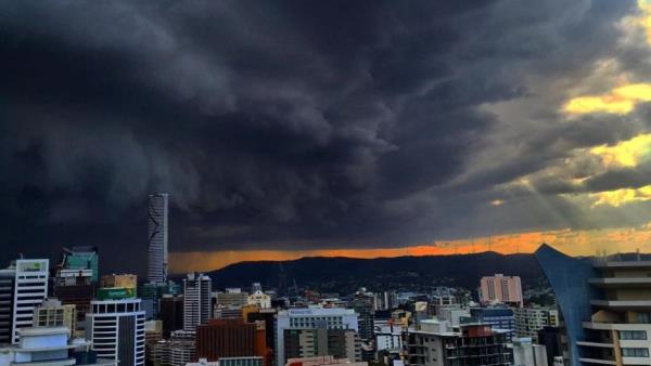
Mr Singh said the storm super cell that ravaged Brisbane and surrounds last Thursday 27 November, was “completely unexpected”.
“We were monitoring the storm cell as it approached Brisbane, but we did not anticipate the storm forming a super cell with such high winds (140km/h), heavy hail and rainfall,” he said.
“It really is re-writing the storm books after it intensified so rapidly.”
Mr Singh said coastal residents should prepare for further storms towards the weekend but it was “unlikely they would reach super cell magnitude”.
“There is some likelihood of hail in the storms and we’re anticipating some very active storms, but nothing to the levels of the Brisbane storm last week,” he said.
Mr Singh confirmed that Queensland was entering an El Nino phase, in which dry conditions would return and unpredictable weather patterns would continue.
The term El Nino refers to the extensive warming of the central and eastern tropical Pacific Ocean which leads to a major shift in weather patterns across the Pacific.
This occurs every three to eight years and results in drier conditions in eastern Australia.
El Nino Southern Oscillation (ENSO) is the term used to describe the oscillation between the El Nino phase and the La Nina, or opposite phase.


